
LinkCalc, or Link Calculator, estimates your link capabilities according to the geographical position and device parameters. It is highly recommended to use LinkCalc prior to link setup. Access is available online here. It requires registration, but it is free to use.
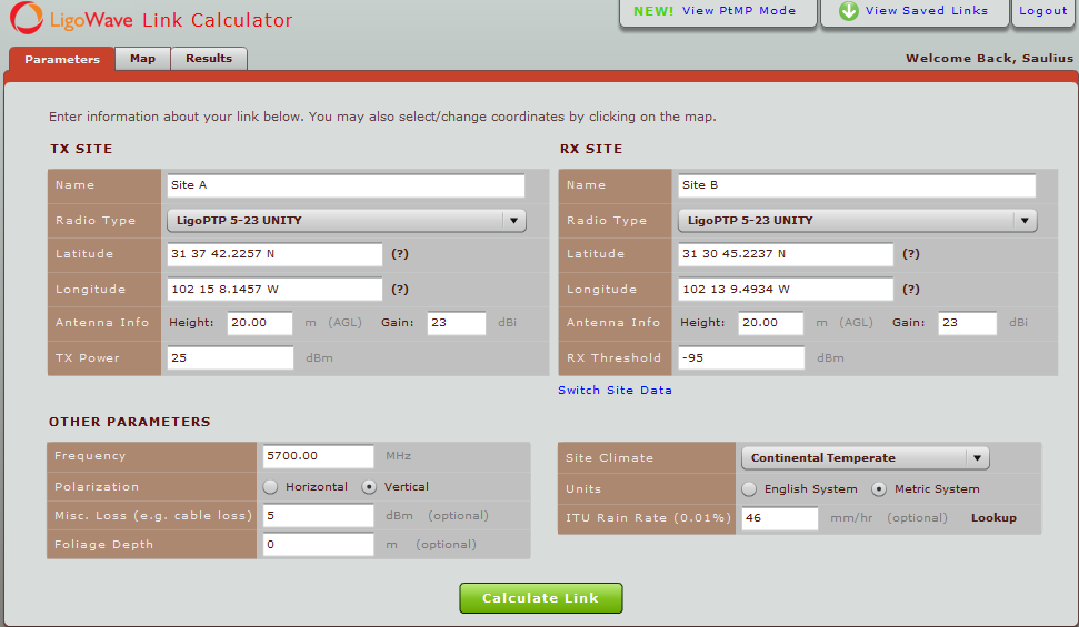
Indicate the following data into LinkCalc:
- Name of each site.
- The radio type (if available) for each site. This will automatically fill in the radio frequencies, transmit powers, and antenna gain. If this option is not available, select Custom.
- The longitude and latitude for each location.
- The height (above ground level) for each antenna.
- The antenna gain (if not indicated when selecting radio type).
- The transmit power (if not indicated when selecting radio type).
- The Rx threshold (the minimum receive signal level that the link will work with).
- The frequency of the radio (if not populated when selecting radio type).
- The polarization of the antenna.
- Any additional loss (cable loss, etc).
- Site climate.
- Units of measurement (Imperial or Metric).
- The ITU rain rate, or click Lookup to get the rate from the data base.
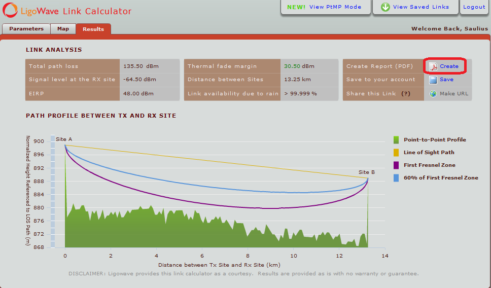
To get a good quality link, it should have clear line of sight, first Fresnel and 60% Fresnel zones. The strongest signal travels in a straight line from the access point to the base station, but alternating terrains may create a lot of reflections. If the Fresnel zone is not clear, reflected signals may diminish the received signal.
Here is an example of a properly established link:
Create Report – generates a downloadable and printable PDF report of the link results.